
Land clearing in Denton County outside city limits comes with two county steps that Collin County does not have: a burn process run by registration and a daily decision, and a county development permit for any improvement to a property. Plenty of building happens out there too. Census Bureau permit data imputes roughly 2,000 new single-family permits a year in unincorporated Denton County (2,148 for 2024 and 1,950 for 2025), an estimate rather than a count. Homestead Land Clearing plans these jobs around the county rules, the ground, and the lake boundaries that clearing never crosses.
Burning runs on registration and a morning call
The Denton County Fire Marshal’s Office allows burning in unincorporated areas only under TCEQ exceptions and only on a burn day. The county makes that call daily between 8 and 9 am, based on TCEQ recommendations or local fire conditions. Owners can call the county’s burn line at 940-349-2840, or, with a current Open Burning Registration, log each burn on the county’s Controlled Burn Log site. Brush, timber and yard trimmings are acceptable materials. Some news coverage has described the county requirement as a purchased Controlled Burn Permit, so the current form is confirmed with the Fire Marshal’s Office before relying on it.
State rules sit underneath. Denton County is in the Dallas-Fort Worth ozone nonattainment area, so 30 TAC 111.209 allows land clearing burns only when no practical alternative exists, with the 111.219 conditions: 300 feet from neighboring structures with sensitive receptors, wind of 6 to 23 mph, and daylight hours. Burn bans are a separate layer. Denton County has used a County Judge’s local disaster declaration to impose a mandatory ban, with violations a Class C misdemeanor punishable by a fine up to $500, so whether a ban is in force is checked on the day. In practice a burn plan here is a day-by-day plan: a pile built on Monday may not be lit for some time. The Collin and Denton burning guide covers the mechanics, and land clearing debris removal is the fallback when the days do not line up.
The county development permit and flood zones
Denton County Development Services requires a development permit for any improvement to a property in the unincorporated county, applied for through its Civic Access portal. A separate trigger covers any excavation in a flood zone: digging, dredging, filling, maintenance of creeks, ponds, culverts and similar work. Clearing alone is not on that list. But a lot cleared for a new house is part of an improvement, and pulling stumps out of a creek bank in a mapped flood zone can look a lot like digging, so that question goes to Development Services before work starts. Pond building and creek reshaping are a separate trade. During permit processing, Denton County Planning requests a rural address from Denco 9-1-1, so a raw tract may not have a usable address yet, which matters when ordering Texas811 locates. The creek and floodplain guide explains why bottoms get extra care.
ETJ rules apply only where a city’s ordinance reaches out, and one Denton County example is documented. Aubrey requires a Site Development Permit before site work in the city or its ETJ that affects erosion control, drainage, vegetation or tree removal, or a floodplain, with a pre-construction conference before clearing trees over 6 inches in caliper. The Aubrey page has the details. For other cities, ETJ reach is confirmed per address, and since Texas SB 2038 took effect on September 1, 2023, owners can petition land out of an ETJ.
Two kinds of ground in one county
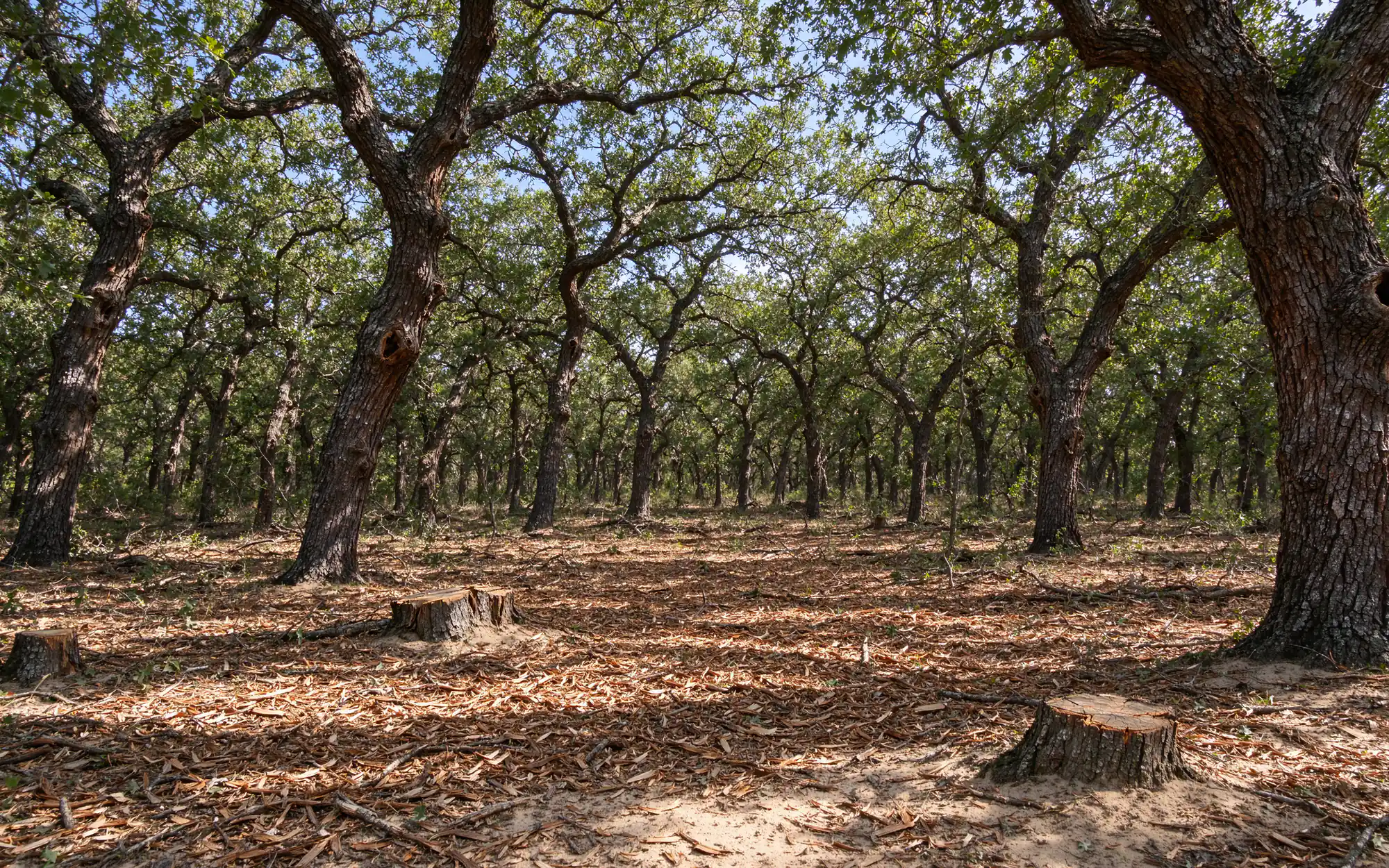
Texas Parks and Wildlife places part of Denton County in the East Cross Timbers, woodland dominated by post oak and blackjack oak with cedar elm and hickory, and eastern red cedar, mesquite, bois d’arc and greenbriar common beneath. Ray Roberts Lake State Park in the north of the county holds dense groves of these oaks. USDA NRCS soil data around Aubrey and Pilot Point shows sandy loams such as Gasil fine sandy loam and Silstid loamy fine sand, which drain well and barely shrink or swell. That ground stays workable after rain far sooner than Collin County clay, but loose sand washes once the cover is gone. Selective clearing or forestry mulching that keeps the oaks and leaves mulch on the soil suits it, and erosion control belongs in the scope. The mulching versus clearing guide compares the two approaches.
Toward Lewisville Lake the ground changes. Soil samples around Little Elm show Branyon clay, and around Oak Point, Navo and Wilson clay loams, which turn sticky when wet. The City of Denton runs a removal initiative for Chinese privet, which forms dense thickets in fencerows and along streams; the invasive brush guide covers it.
The lake also sets a hard edge. The U.S. Army Corps of Engineers generally owns land at or below elevation 535 feet around Lewisville Lake, prohibits removing vegetation on that public land, and requires written permission for any work in the flowage easement up to the 537-foot contour. Clearing on a lakeside tract stops at the government boundary markers.
How an unincorporated Denton County job usually runs
- Walk the property. Boundaries, trees to keep, slopes, wet spots, fences, and anything buried or overhead.
- Check the rules for that address. City, ETJ or neither; county development permit and flood zone status; Corps boundary on lake tracts; burn registration; Texas811 locates.
- Write the scope. Method, finish level, stumps, debris plan and erosion control, in writing, before a price.
- Clear and hand off. The site is left at the agreed finish, ready for the next trade or for seeding.
Open pasture work, from pasture clearing to clearing and grubbing mesquite, follows the same steps. Budget ranges are in the cost per acre guide.
When you know which side of a city line and a flood zone the land sits on, get in touch and the scope gets written from there.